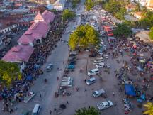
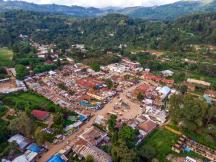
The idea of meeting at a specific place and time to trade is so deeply intertwined with the idea of goods exchange itself that in many languages, the word 'market' has both meanings. These focal points of economic activity are long-standing and widespread features of economic geography, and remain central to livelihoods in rural areas of many developing countries today. Here, farmers sell their products and access otherwise unavailable goods and services, thus interacting with the broader economy. Despite their ubiquity and importance for rural trade, however, it is poorly understood how rural marketplaces shape local development.
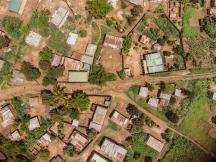
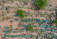
This lack of understanding primarily stems from a lack of data. Since marketplaces are typically the mode of trade in informal, non-urbanised economies, it can be prohibitively expensive to collect data on their locations and economic indicators around them. This project addresses this data scarcity in the context of Western Kenya over the last five decades by combining historical records and modern data based on satellite imagery to document patterns of weekly markets and, as a measure of local development, population density around them. The research team interprets these patterns through the lens of a spatial model in the New Economic Geography tradition that includes rural marketplaces as population-independent locations of trade. The model makes it possible to identify possible mechanisms behind the stylised facts and qualitatively examine which complementary policies catalyse markets for local development.
This project sheds light on a key link in value chains, the evolution of market locations over time. While many governments have recently reinvigorated their agricultural development programmes, policies like rural road construction and input subsidies are often only roughly targeted geographically, partly because actionable information is missing. Identifying areas of relatively high and low market access would help implementing policies efficiently. Additionally, the project fills a critical data gap. The use of satellite imagery for mapping market location can be applied to a wide variety of research questions across a broad set of countries, and the increasing frequency and quality of this data only serves to improve this method of data collection in the future.
The project finds that weekly gatherings can help reduce transport costs by enabling the bulking of goods, and can provide the customer base for aspiring enterprises in rural areas. Through these functions, markets may form nuclei of local development in rural areas, especially so if they are well-connected to their hinterlands.
